The Amazing OSM Community, and the Tasking Server, Maps Swaziland
Posted: November 10th, 2011 | Author: mikel | Filed under: mics, openstreetmap, swaziland, tech | Leave a comment »One month ago, I asked what to do with 10 million GPS points, and it turns out one awesome answer is map an entire country.
I wanted to experiment with the new HOT Tasking Server, so I set up a task using the Swaziland GPS tiles, but I didn’t bother to promote the effort at all. One month later, and the task is 100% complete, and about 25% verified. Amazing work by the community, and a quickly proven, easy to use, compelling tool.
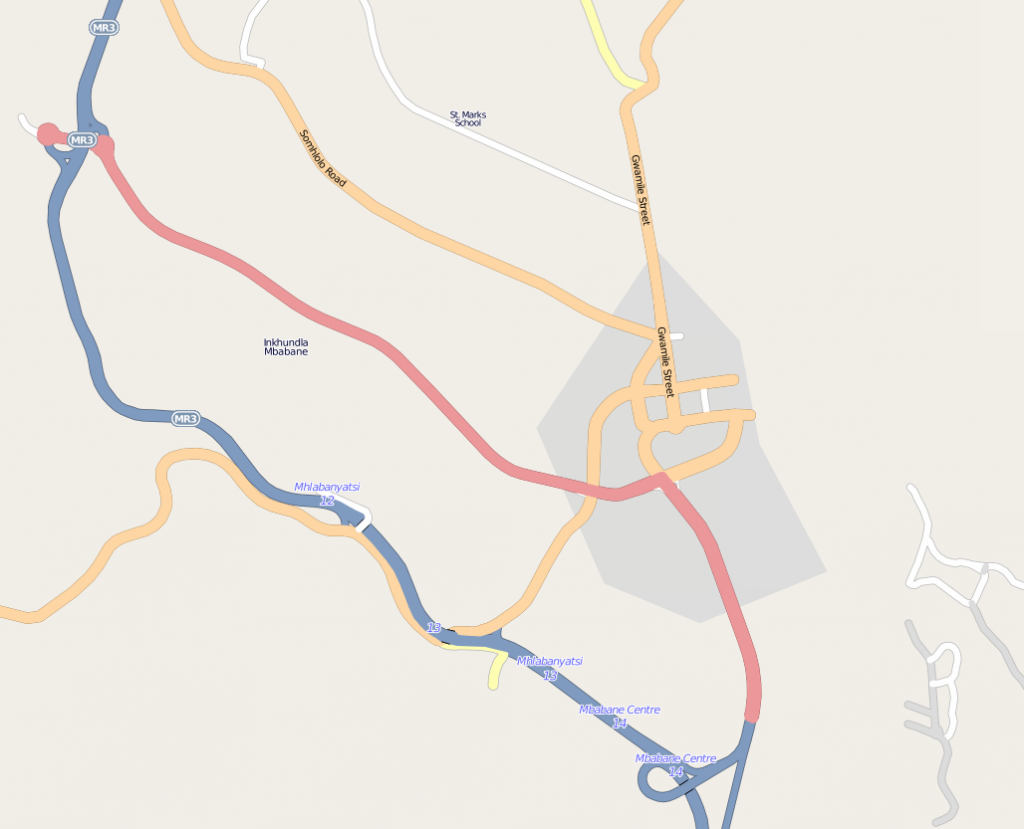
Here’s Mbabane, the capital of Swaziland, before the editing.
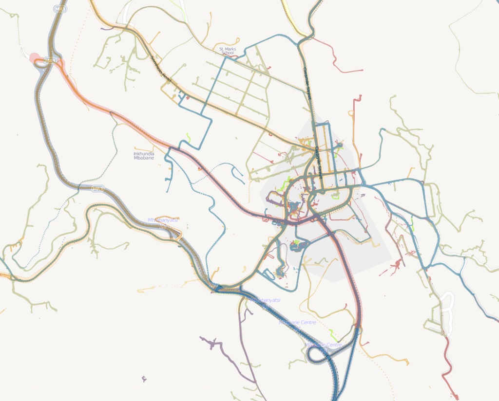
And here are the GPS traces of Mbabane, today.
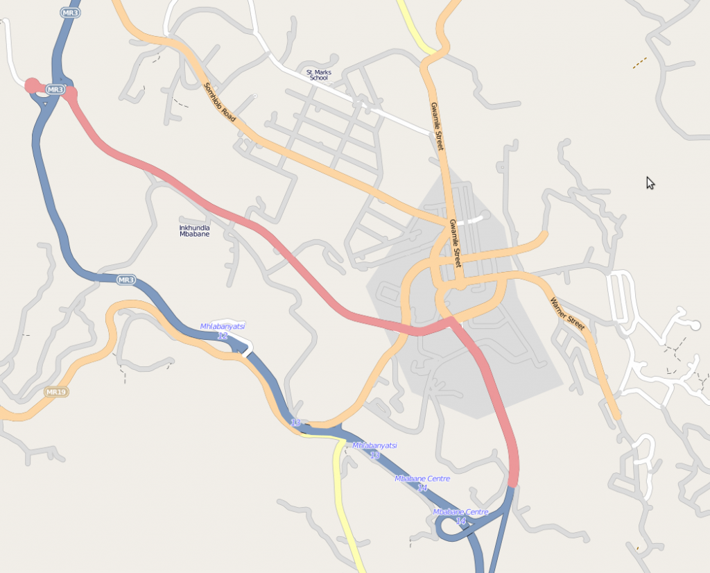
And finally, the map today.
New roads have been filled in throughout the country. It would be interesting to calculate the growth in road features over this month.
There are still lots to do. There are gaps in the GPS coverage, and Bing might help. This was only roads, and unnamed, unclassified roads at that. It’s really now up to the small and growing community of mappers in Swaziland to bring the map alive.
I asked some of the incredible top contributors about why they took part in the mapping, and how the tasking server helped out.
The tasking tool is really nice to keep the motivation up and to keep track of what’s already done. You see the progress and the small chunks are mostly manageable.
It is good for my inner self. It is rewarding on both a greater scale (creating a needed map) as well as a smaller scale. Also, I find tracing a very relaxing activity that leaves my analytical programmer’s mind open for podcasting, talking or just recuperating from the day.
It was a chance to contribute to a very underdeveloped part of the map and make a real difference to what was available in that country. This is also a country that would take a long time to reach a critical mass of roads without outside work. Hopefully this will give a base for people when they look at a rendered map, which in turn might encourage other people in/near Swaziland to fill in the gaps.
I like mapping because you get to look at somewhere in more detail than you normally would. I now have a real feeling for the geography of Swaziland.
I’ve been interested in HOT for a while and participate when I can, but it’s not always clear how to contribute. The task manager made that easy. To the larger question of why do this at all: it’s like knitting a sweater for millions of people at once.
I think it’s important to get the tile size right. For the Swaziland tracing, it was perfect. I peeked at another task (tracing buildings in Indonesia) and a single tile was too overwhelming.
stethoscope’s insight on the right tile size was among many great points of feedback. We’re learning lots about how to improve the experience of the tasking server even more, that’s getting captured in issue requests, and Pierre continues to push development.
It was after Haiti that this idea began brewing, with identified need for “Mechanical turk style process for working through and importing individual features from large imports” and “Tools for ongoing coordination and identifying needs, addressing the problem of what to map now?”. And really, it goes back to the search for Jim Gray. At my talk at Microsoft last weekend, I was fortunate enough to meet some of the team who worked on the first mechanical turk process for collaborative imagery interpretation … the inspiration has results!


