Unpacking Bangalore’s Tech Activist Scene
Posted: March 30th, 2012 | Author: mikel | Filed under: India | Leave a comment »Erica Geeked Up in Bangalore, and give a talk “From Information to Empowerment: Unpacking the Equation”.
Nice to follow in the footsteps of Hapee’s GeekUp on OpenData.
The talk surveyed our work with GroundTruth, in community mapping and media, in Kibera and elsewhere. Got a nice write up in The Hindu. And a reprise with the warm and progressive parents of the Earth School Montessori school.
In between, Erica attempted to sweep through and catch up with as many of the interesting movers in Bangalore. Finally got to meet in person with IT For Change, who were among our collaborators on the IDS research project Mediating Voices, Communicating Realities, and are particularly interested to see how participatory mapping and media can apply in rural settings.
Sridhar Pabbisetty, from the Center for Public Policy at IIM Bangalore, welcomed Erica for a talk and time with his students. And also, facilitated a visit with CHF’s slum improvement projects in Bangalore.
Another highlight was meeting with Jaanagraha, the group behind the amazing I Paid a Bribe. A key component of the strong anti-corruption movement in India, and now inspiring similar efforts worldwide, was very instructive to hear how this campaign took hold.
An intense few days … felt deep, and yet just scratching the surface. So much more to loop together next time in the Bangalore tech activist scene!
Cartonama, Open Mapping in Bangalore
Posted: March 29th, 2012 | Author: mikel | Filed under: events, India, talks, tech | Leave a comment »The keystone to GroundTruth’s trip to India was the Cartonama workshop in Bangalore.

My comrade in maps was the amazing Schuyler Erle, in a reprise of our epic 2008 Free Map India tour. India, Banalore, and its OpenStreetMap have transformed (as you can see in this heart-filled animation of OSM Bangalore). This time, rather than visit 7 cities in 4 weeks, we crammed even more information into two days. As ever, I learned a ton from Schuyler. Perhaps the choicest bit being, “Canada is often projected as if the Earth was wearing a dunce cap”.
This was an intense two day workshop, covering everything needed to make an open web mapping application: from data collection in OpenStreetMap, to data juggling with OGR/PostGIS etc, making tiles with TileMill, and finally building an Ajax Web app with Leaflet and the OSM API. Oh, and also a survey of basic geographic concepts (geodesy, projections, etc), and the intricacies of the operation of GPS satellites. Really it was four workshops in one. Or maybe 10. Possibly a semesters worth. I think it’s a format worth replicating.
The end result was a modification to the amazing POSM POSM by Yuvi Panda. He built this HTML5 web app for first collecting bus stops in Mumbai. There were wonderful audible gasps when we integrated our home baked MapBox tiles into the locally running POSM app (even if we discovered lingering problems with handling of Indic fonts in Mapnik).
You can see all the presentation materials on GitHub. We collaborated on the slides in Markdown with Landslide, best way to make a presentation.

Cartonama was an Editor’s Pick in TimeOut!
Another great moment, during the ice breaker we stole from Gunner: “What’s your first memory of a computer?” “We had to take our shoes off before going in the lab because computers are holy, right?”
It seemed to go well. Was great to enthusiastic, creative participants from Servelots, TacticalTech, IT For Change, Transparent Chennai, and many others.
HasGeek did a wonderful job bringing bringing the workshop together, and are lighting up the geek event space in India. They’re really fostering community in the best way, and I’m excited to see what happens with all the mappers from our workshop, and the upcoming full Cartonama conference. So big thanks to HasGeek, and the Centre for Internet and Society for hosting and sponsoring the workshop.
Journalism and Mapping, Presenting to Armenia
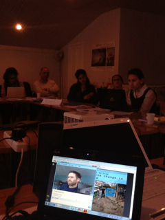
Posted: March 26th, 2012 | Author: mikel | Filed under: talks | Leave a comment »Today was my second opportunity to present to Public Journalism Club in Yereven, at the invitation of Seda Muradyan. This a group of journalists, working with new technologies and approaches, especially for the upcoming election. It’s excellent to present GroundTruth’s experiences, particularly Map Kibera’s 2010 Referundum monitoring, which shows how maps and journalism can really connect for a powerful story.
That’s a very small video of me, talking to a patient audience through a translator. I’m still amazed that anything like this is possible on our planet.
The group has set up an Ushahidi instance, with OpenStreetMap base map, to monitor elections: http://iditord.org/. Look forward to seeing how the Armenian election develops.
The slides:


