Tanzania: Involving Community Organizations
Posted: August 30th, 2011 | Author: Erica Hagen | Filed under: Uncategorized | Leave a comment »
The first community forum went well. It was deal breaker for the project in the sense that if we didn’t get the community to share our ideals and objectives, making them their own, then the project would fail. Now the map is basically complete for first draft. We have enough of a basemap so we can now support platforms like Ushahidi and enable blogs to be geolocated.
Collecting the data and producing the map, as I’ve previously mentioned is only a first step. The same can be said for involving the students and community members. By creating a small nucleus of highly engaged people, proficient in mapping and storytelling techniques understand the project, they can evangelise the project to others in their community. This ‘infects’ the community from the inside allowing for more people to interact and share the project without ‘outside’ involvement. This will in time hopefully reach a plateau where the entire process of updating the map, reporting and blogging becomes self-sustaining using only the initial equipment and investment.
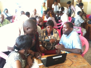
With this in mind, in the build up to the final community forum of the project (where presentations will be made to the community as a whole ie. interested citizens, civil servants and politicians) we gave a ‘pre-release’ talk to ten community based organisations. The format for this was quite simple, the students introduced the map with it’s features and intended functionality and the community members introduced the storytelling elements.
Within this process I spent most of it being a photographer and an observer. It wasn’t quite seeing the monster you created evolve but when presenting both students and the community are owning the process. The community organisations engaged in a Q&A session then participated in reporting using Ushahidi.
During the Q&A many questions dropped out regarding the future of the project and how the map can be used further. Because we are still formulating the future strategy it is difficult to say what the next step will be, but it will be along the lines of franchising to other areas overseen by community, NGO/CBO and Ground Truth, constructing this framework will be taking place for much of the coming week.
We are also printing the map and distributing it. This is key; in using Open Street Map, the collected data is freely available for viewing and data analysis without restrictions like a prohibitive licence. However accessibility to computers and internet understandably is a problem in communities like Tandale. To enable the community to view their map we will be printing A2 maps for placement in the sub-ward offices and printing A4 sub-ward handouts.
By placing it in a communal areas for each of the communities, we aim to reduce the barrier of people using the map by making it accessible. This process has started with our small nucleus of students and community, expanded by involving community based organisations and will be expanded further by integrating the map into governmental offices at the sub-ward level. Having the map built into the fabric of the community from the beginning of the project should make further incremental additions easier.
Community organisations being fully involved in the project is the next step, the process has been started and the ball is rolling. However Eid is coming in the next week, so everything is going pole pole, Swahili for slowly slowly. However tangible results are starting to become very clear, on all levels with all stakeholders.
Originally posted by Mark Illiffe on his blog on August 29, 2011. Mark is working with GroundTruth in Tandale, Dar es Salaam this month introducing community mapping and reporting to Dar es Salaam residents, in a project supported by the World Bank and Twaweza.

