Community Mapping: Frequently Asked Questions
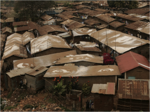
Posted: July 16th, 2012 | Author: Erica Hagen | Filed under: Uncategorized | 5 Comments »Community Mapping is not a new term, but it seems to be enjoying a makeover due in part to the impact of new citizen-led mapping efforts, like Map Kibera, GroundTruth, and others using OpenStreetMap all over the world. It’s been popping up everywhere lately, so I thought it might be time to look into just what IS community mapping, exactly?
Policy Link reported back in 2002 that:
The terms community mapping and GIS are often used interchangeably. We define community mapping as the entire spectrum of maps created to support social and economic change at the community level, from low-tech, hand-drawn paper maps to high-tech, database driven, internet maps that are dynamic and interactive.
Meanwhile, an organization called Center for Community Mapping uses mostly Google maps to build software and then license it to others to use, with the expressed purpose of “empower(ing) grass-root stakeholders with mapping technology to foster participatory planning, community education, and cooperative organization”.
The first definition above is very broad, and doesn’t say anything about the role of community members themselves; the second does talk about empowerment but does not use open data standards.
Mikel recently presented and posted about this topic, saying “…the excitement of community mapping is beyond the data that’s being created, but the possibility of a fundamental shift in the power dynamics of how development is practiced. If people know the facts about their own lives, they have more power to call to account those institutions which are supposed to serve them, and ultimately, to improve their lives themselves.”
That’s the beginning of our approach. But, to be more explicit, here’s the GroundTruth take…
Frequently Asked Questions about Community Mapping:
Does Community Mapping need to involve the community, in the mapping?
Yes, it does. In the first definition above (the one that equates CM with GIS) it’s more about “mapping of a community” than “community mapping”. To me, that’s just plain mapping. Or perhaps, using GIS to understand a place, which happens to be a particular neighborhood.
Does that community actually have to live in the place where the mapping is happening? Isn’t it enough if they’re from somewhere nearby?
I’d again be pretty strict about that. If it’s called Community Mapping, people should be mapping in their own community, not the one next door. Why? Because we believe this is about participation, and not just about data collection. It’s also about giving people a chance to show what’s happening in their neighborhood from their point of view, in this case through the medium of a map, and about their own use of the information later.
How about if other people map the community and then later involve members of the community in a presentation about the mapping, is that still community mapping?
Not really. It’s just mapping, again, that happens to take place in a community.
Does the community need to own the information collected during the community mapping? Does it have to result in open data?
They don’t need to own it, but we do believe in free and open data as a critical part of community mapping. After all, the point is not to help companies build their commercial base, or to hand over more information to proprietary silos inside NGOs and governments, never to be seen again. The idea is to create a commons of information that can lead to greater transparency from the local level on up, and allow many people to leverage that information.
So, Community Mapping is another way of saying, “the community is actually doing the mapping”. Does that mean they’re using the technical tools themselves? Isn’t that too hard?
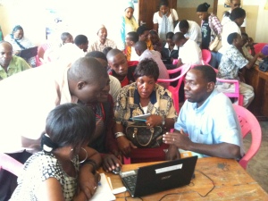
In our experience, most people learn quickly to use basic mapping tools, within reason. If students from a nearby university, none of whom live in the community, do the mapping, or if a great local NGO decides to map the local slums, hiring professionals or finding volunteers or using their own staff, none of whom reside in the slums, then that’s not community mapping. If people get their hands on the tools and learn to make the maps (as part of a larger process of participatory planning, information-based advocacy, or other local processes) that’s how we define the CM practice. Yes, we’re going pretty far here in saying that people actually do some technical work rather than perhaps walking around with a more “expert” mapper showing them what is where. There are probably ways that some technical support can be integrated, and certainly not everyone in the community needs to be doing the mapping. But it is part of the premise of OpenStreetMap, that such resources can be created by crowdsourcing, and they make it easy enough to do so.
It’s possible that community mapping can happen without a lot of technical training, though, and using different paper-based integrations (walking papers, etc). Perhaps the key point to make here is, if the goal of your project is explicitly to do community mapping, don’t assume that residents can’t or won’t want to do it themselves. And, as long as your project is done in such a way that prioritizing community empowerment and participation (and check on this carefully; it’s not common), coloring outside the lines of this FAQ is very much encouraged.
If I’m using OpenStreetMap, isn’t that automatically community mapping?
No. It’s great that you are using this user-generated free and open map of the world, though, and thereby contributing to the liberation of data worldwide for generations to come. Please don’t stop. And you might be doing community mapping, but not necessarily.
Is Community Mapping the same as Citizen Mapping?
The name is cleverly different from community mapping. While they could be the same thing, it’s interesting to consider that citizen mapping might imply less of a community-based process, and align more with movements like citizen journalism, imagined to be something done by individuals using their personal mobile devices and things like that. However, in places we’ve worked, that’s not quite how citizen media works either. At this point, I believe the terms can be used interchangeably, and we have definitely used both terms.
Does Community Mapping need to be Open?
I suppose not. But if it’s not, why not? Is it because some of the information collected will endanger a person’s rights in some way, infringing on privacy (household ownership data might)? If not, then yes, it should probably be open. Why? It’s a public good. This might require a fuller debate, but unless the community comes together and decides based on a clear understanding of the implications of free and open vs. private data that they need to restrict access, open should be default.
Does Community Mapping need to involve Citizen/Community Reporting or Media?
It is important to have a well-thought-out means for people that are making maps to use the information and build off of that base. A very effective way to do that is to introduce different kinds of reporting tools. This is because people get excited about their neighborhood and have more to say – the map can’t really finish the job, it’s just the beginning. Also, there’s a story (or several) behind each point of interest. I can imagine there are other ways that people can really engage around what they are seeing and use it, but the point is to go beyond the map somehow and allow people to tell stories with the data. Using something like Ushahidi or basic blogging and citizen journalism to illustrate community perspectives has been exciting in our work – in part because it is not restrictive about what people may want to say about themselves.
Is this the same as Participatory GIS?
Not quite. Participatory methodology should be part of both and PGIS is one of the inspirations for our work; community empowerment is also key to both. Traditionally, though, PGIS is closed and the information gathered in the process not intended to be shared openly (for re-use, etc). Also, that process doesn’t typically impart the technology skills to the participants.
So what exactly IS community mapping? Briefly.
Here’s my shot at the criteria.
1) Community creates/gathers the map data. That is, geographical coordinates alongside any other information (we’ve collected things like number of nurses in the health clinics, all the way to why one mother takes her child all the way to the other side of Kibera to see a doctor and what path she uses to avoid the street thugs).
2) Community also edits the map data themselves, and comes to agreement on the final product.
3) Mapped information is generally shared openly, online, contributing to commons, unless otherwise specified by the community and after a good discussion of the options.
4) Community uses the map afterwards, themselves. This might be the biggest challenge in practice, but there are plenty of people who have been using maps in local development for many years who can support on this point. We recommend introducing storytelling and media around the data through other tools for online expression. The mapping also can be part of a larger participatory development, local planning, or advocacy process.
Is community mapping the easiest/most efficient way to get the map I want?
Not always! In fact, it’s a time-consuming, complicated, logistically challenging, and just plain difficult way of getting a map made. But, getting a truly good map is usually time-consuming and difficult. Don’t forget, it’s the locals who know what and where everything is in the first place. Here you have to distinguish between the tendency to want a quick result, and the actual usefulness of what you want to produce in the long run. The idea with community mapping, when it uses OSM in particular, is that the resulting maps can be easily updated down the road when things inevitably change. You’re investing in creating local skills and a local network of mappers. Of course, you’re also investing in empowering citizens, but even if you just want your map this is a good way to make sure that the map isn’t useless in five years.
You can ask anyone who’s done one of the following things: community organizing, community development, participatory development, for a fuller explanation of the long-term benefits of the process and their challenges. We would place community mapping inside this constellation of methodologies.
But, what’s the point of making the map, if locals all know where everything is? Aren’t maps mostly for government planning or getting from place to place?
Well, not anymore. We think people can influence that planning (or cause it to happen at all) by doing community mapping. And, well, there’s a perhaps less celebrated motivation here for doing this mapping/reporting/making oneself “visible”. It’s been our exciting experience that people really care about having the truth about their lives come out and be heard, seen, verified, in essence validated. Of course, we’re working with communities that are in some way disenfranchised, but so are many others who would want to do community mapping. We started out (with Map Kibera) investigating the interest in, motivation and usefulness of these tools by people in the community, so I’m really looking at what I’ve seen matter to them.
I welcome your feedback and comments, below. Please discuss with us!
Kerala exploratory visit
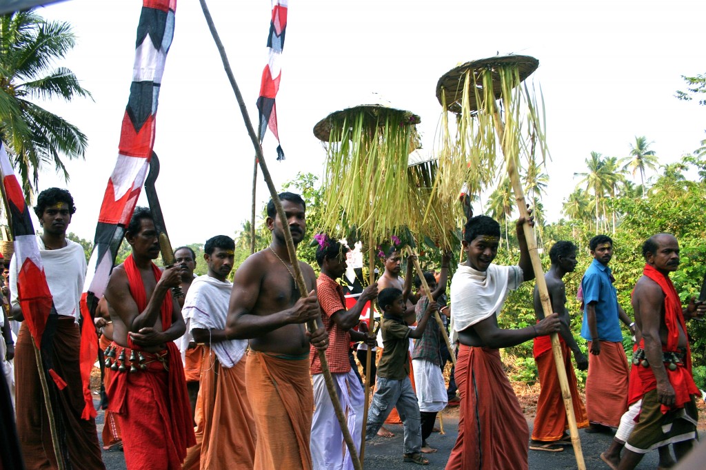
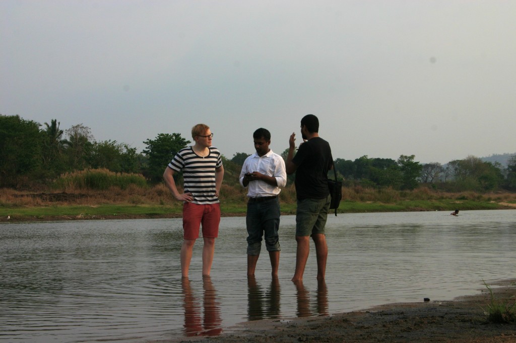
Posted: April 25th, 2012 | Author: Erica Hagen | Filed under: India | Tags: crowdsourcing, cultural heritage, tourism | 3 Comments »In March, GroundTruth went to Kerala, India at the invitation of The Blue Yonder, a “responsible tourism” outfit operating throughout India and based in Bangalore. Not knowing quite what to expect, we nonetheless jumped at the chance to work on a project about crowdsourcing the cultural history of the Nila River. Nila is one of the destinations that Blue Yonder knows best. Its founder, Gopinath Parayil, is a native of the area, which is in the northern part of Kerala state. Prakash Manhapra, another TBY staff, is a lifelong resident of Tirur, a city near Nila, and has absolutely encyclopedic knowledge of the region. Better yet, he has the curiosity of a journalist and an instinct for drawing out a fascinating tale from just about any bystander we came across.
Our task was to take a look at the wealth of cultural activity and history in the Nila basin, much of it very place-specific, and devise a methodology and training for turning this into an engaging multi-input platform for showing off the local riches. This all with a view toward drawing out elements for the tourist to seek out and enjoy, giving locals a chance to celebrate their heritage, while providing a means for preserving not only some of the more fragile customs and artistry but also the very river itself. Besieged by a long-running sand excavation, the “sand mafia†controls an often illegal but overlooked sand mining operation which is quickly destroying the ecosystem of the river linking the fascinating human settlements together over millennia. The hope of Blue Yonder was that the platform would help fight the environmental battle underway by reminding people how interlinked their lives were to this river.
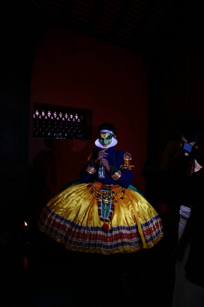
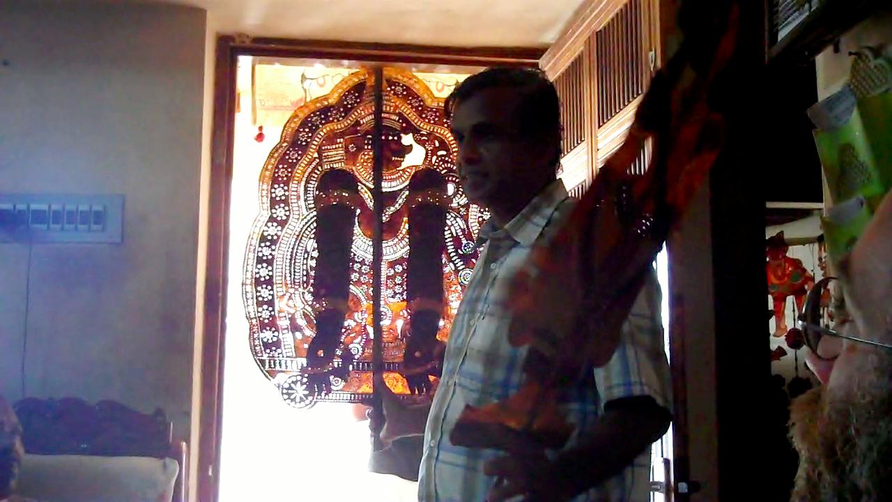
We took a welcome opportunity to use some of the same tools we’ve developed for slum residents to report on basic services and needs, Palestinian activists to share their efforts to retain their land, and Nigerians to share crime and security reports, to the more cheerful topic of highlighting a rich cultural heritage. And Nila has plenty of positive to share, as we discovered. We visited artisans making bell-metal puja sets, handweaving cloth, and throwing clay into cups and bowls in ways that reflected centuries-old traditions. We visited ayurvedic doctors, martial arts practitioners, traditional dance and Kathakali theater, even an all-night shadow puppet performance that is enacted for many nights in a row with or without audience, to please a watching goddess.
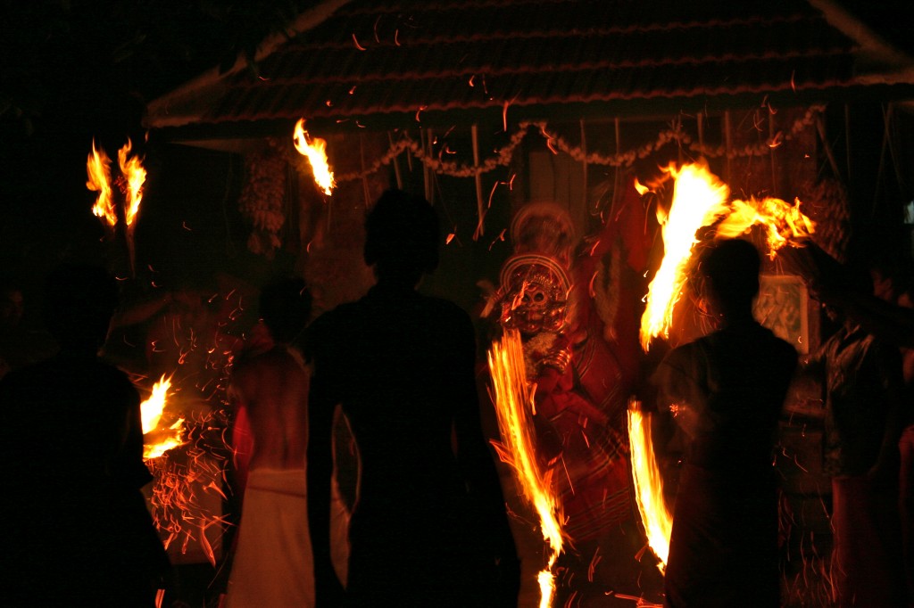
There was the unplanned too – we happened upon a tiny village festival featuring frightening fire-theatrics and elaborately made-up ritual performers channeling the snake deity. At another nighttime temple festival a band of drummers played relentlessly and ecstatically for hours until they stopped all together on a dime, leaving a haunting ring in the air for several seconds.
I also got to see elephants. Though some looked a bit sad.
Mesmerized as we were, we got down to business. Developing a system for recording some of these events would not be the challenge; even collecting media might be easy given that everywhere we went we saw cellphone photography and video in process. Kerala is not particularly poor; the historically communist-run state is proud of local development and a small fortune has been sent back from migrants overseas in the Gulf. Building a way for locals to interact would require, yes, a mapping of the area as well as a variety of ways to report through media and aggregate. We also wanted to involve the artisans somehow, so that they would receive more business, and integrate a social interface for recent visitors and tourists to submit media and interact with locals. Of course, the primary language in the area is Malayalam, complete with its own swirly script. Interaction with the site would have to be possible through Malayalam-enabled keyboards, Romanized inputs typically used with mobile phones, and English.
As usual, the wild card would be the community-level participants – who exactly would be energized to report, on what, and who would sustain the enthusiasm? Options included working with a fantastic local group Vayali, already dedicated to exhaustive cataloging of local culture for academic and other purposes, as well as a widespread project of youth engaged in a volunteer palliative care movement. These youth had the civic engagement spirit along with local knowledge. We could also access a mass-media outreach campaign to engage more contributors. Integration with social networking online was also important.
This project sparked a long-dormant passion of mine to preserve and protect traditional social and cultural practices which I believe are in similar (and related) peril to the ecosystems that are being systematically destroyed. There is an interrelation between the attention that one can focus on a cultural feature, and its survival in the face of immense economic and social pressure to conform to the dominant or “modern†culture.
Gopi showed us traditional Keralan architecture, which is being replaced, like everywhere, by cement block ugliness. I sometimes think of how the houses in my hometown were remodeled in the 1950’s to reflect the day’s mores, eliminating all the wood trim and tin ceilings. It’s only now that homeowners are trying to reconstruct what was damaged back then, which is never as good as the original. Gopi has convinced – sometimes by actually offering payment – some owners not to destroy but to preserve the traditional houses, by insisting that tourists would pay handsomely to stay in these beautiful lodgings. Running a tour company, he has some authority to make this claim. Examples of expensive “traditional†lodging abound, usually only as imitations. (Here’s a cool example of architectural preservation and tourism in Kathmandu).
Sometimes, locals do not realize that what they have always had – traditional architecture, artisanry and crafts, medicine and religious festivals – can be extremely valuable to the visitor as well. Of course, there is the danger that such practices will become museum-pieces for benefit of tourists alone. That is something we experienced in Kenya, where safari tours visiting colonial-style lodges will be presented with a song-and-dance performance abandoned by the actual representative tribe years ago. The effect was, for me, disturbingly patronizing. There’s nothing quite like seeing Kenyans dressed proudly in their costume on property once part of their spiritual homeland, in front of white haired foreigners supping on mashed potatoes and corned beef, in a lodge built by British colonials. But I digress.
The amazing thing about Kerala (and other parts of India) was that in no way was any of what we saw put on for our benefit, and yet, a visitor could still inspire pride and represent a financial incentive to support certain elements of culture. With our system, we hope to expand that experience to reporting oral history, heritage, cuisine, and other aspects of the river culture that make the place all that much richer. For example, there are archaeological remnants of an old trading route that tied into coastal shipping routes, pit-stops called Athaani that traders used to use for rest and refreshment, which we hope to map and annotate with interviews along the way. Only it won’t be us – as usual, only the community members will contribute, no outsiders, no researchers, no foreigners or even local city-folk. That kind of process, I hope, will lead to local ownership not only of this technology but also of the Nila itself.
Benin City, Nigeria
Posted: April 19th, 2012 | Author: Erica Hagen | Filed under: Nigeria | 1 Comment »GroundTruth is embarking on another iteration of – and new contextualization of – our mapping-reporting work here in Benin City, Nigeria. We arrived a week ago, and are beginning to make sense of the project and lay the groundwork for the pilot.
Benin City is the capital of Edo State – part of the Delta region technically, but without the “oil curse”.
The Benin project is a partnership with the ICT Directorate of Edo State, supported by the World Bank. We are also fortunate to have on our team, Dr. Steven Livingston of George Washington University, in DC. Dr. Livingston is a professor at the School of Media and Public Affairs and researches ICT use in developing country contexts especially for political purposes; he has also recently been researching policing and security in Nigeria.
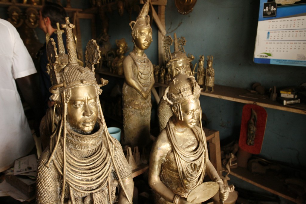
The current project has a few different goals, primary among them being the creation of a (geographically-situated) information channel or network between community members, government, and the wider public, with an initial focus on crime and security issues. The rooted nature of the project means that we will begin in a particular district or “local government area†known as Egor. During this trip, our main task has been to get to know the actors at the local level who might benefit from the project, and essentially map out the roles for various stakeholders, to use development lingo. We have met several local governance activists and civil society leaders, a community-based girls empowerment NGO, a professor of sociology at the local University, and a company responsible for kickstarting the government GIS department.
We also met the traditional leader of one community, known as the Enogie. This is a member of the historic Benin kingdom, which once posed fierce resistance to British rule and whose structures are still functioning and highly respected here.
We have gotten to know the ICT directorate staff, and it has occurred to me more than once that there are quite a few governmental or quasi-governmental (private sector or Bank-supported) staff putting a lot of energy into this pilot. This, it cannot be overstated, is not always the case; perhaps even unusual. It is highly motivating that we have such a commitment. Edo state also benefits from being known for its especially engaged and effective governor Adams Oshiomhole – at least, this is what we have been told by several people, from our taxi-driver to young government underlings to a variety of civil society leaders. I can’t give evidence beyond that, but, well – the norm in Nigeria is pure kleptocracy. Some infrastructure is being built now in Benin including several roads, a new hospital, and public spaces. People are overjoyed.

Typical road conditions in the rain
The ministers overseeing some of these projects are also, well, serving the public and engaged. Some of the officials we’ve met have been recruited to come back home from overseas in hopes of making a difference. This is eye-opening, not only because of the reputation of Nigerian government at any level, but also to inform our overall work, since I have seen so little positive governance in Kenya. I hope that some outcomes will be achieved that show what can happen when government is connected with technology to the grassroots. I might be too optimistic, but it’s a good note to start on. (Note to voting Kenyans: this governor was previously a labor leader and activist, ie, he had a record of taking a stand on issues publicly. Also, yes, his election came at a cost- he was first declared to have lost until public outcry overturned the decision.)
Of course, we’ll be facing the usual challenges of electricity and connectivity, as well as transportation, but much more so than in Kenya or even Tanzania. While road repairs are coming in slowly, many spots become impassable when it rains. Nigeria’s systems are notably unreliable, and the vaunted undersea broadband cable hasn’t connected with Benin. But, again, “everyone’s on Facebook†– the magic mobile connector. We’ll be going back to mobile-phone based or WAP browser interface, with data management or long form submission a possibility at the higher levels.
An element of the project is to generate better information on crime and security, in juxtaposition to environmental and infrastructure mapping and community-determined priorities. This richer information will support the police (and others concerned with security) with the kind of analysis they don’t currently have. The pilot concept was set off by the idea that urban upgrading coincides with crime reduction, and vice versa – a variation on the “broken windows†theory. The idea is that we’ll actually see a trend relating infrastructure with crime rates. But is it really true that something referring to middle-class neighborhoods elsewhere could transfer here? Or as Dr. Livingston put it, the broken windows theory applies in places where windows are the norm. It will probably be less concrete than that. Again, I’m glad there are a lot of brains waiting to take on the incoming information – I often wish that there were more analysis of the rich information that can be found in Voice of Kibera.
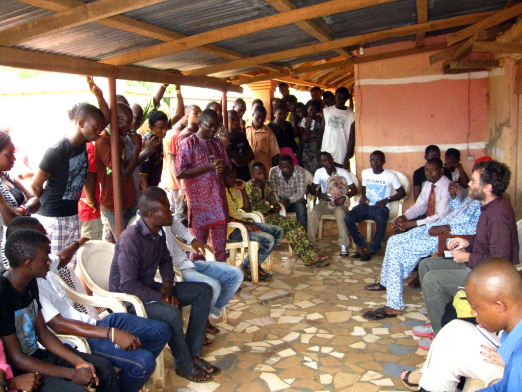
It will be interesting to take the project into the community –always the part where theory fades and reality hits, and concepts and plans become tangible successes and failures. We’ve already taken a stab at this during our meeting with the Enogie and “youth†– where our request to meet 5 turned into a group of more than 50, excited and challenging us at the same time. Here’s where I started to feel comfortable with the project, more familiar – where the purpose for me becomes clearer – where the excitement builds and people start to get curious and shape the direction of what has so far been conceived in rooms far away, by people who might never meet these soon-to-be reporters and mappers. Our ultimate responsibility is to these people, and the many others we’ll meet, and I hope that leads as it has in the past, to something remarkable.
Instrumentalism vs Empowerment; or how to think like an artist
Posted: December 16th, 2011 | Author: Erica Hagen | Filed under: Uncategorized | Leave a comment »JR, the now-famous artist recently recognized with the 2011 TED prize, once plastered the rooftops of Kibera with close-up images of womens’ faces. The striking images often featured in our presentations about Map Kibera, because without knowing anything about the artist or the intent, shack rooftops covered in human visages resonated with what we hoped to do with our work: make the “invisible†visible, and humanize the apparently inhuman slum. A recent New Yorker article provides interesting insight into JR’s work.
JR is now undertaking a massive project of printing out other people’s self-portraits on jumbo poster paper so that their own images can be plastered like graffiti around their communities, or elsewhere.
He is, in a sense, taking the concept he started out with in Kibera and other marginalized neighborhoods and taking it to its logical conclusion: creating an army of graffiti-artist self-portraitists. Though he tried to practice his art in secret by hiding his identity and using renegade graffiti methods, it still earned him personal fame and fortune – turning the world’s attention back on him. It seems he’s again tried to push the lens back to the people he photographs, by serving as their printer. Whether it will succeed is not yet clear; to me the images start to look like a giant paper Facebook. But the example led me to consider further the meaning behind self-representation in a slum.
While building the various tools of representation in Map Kibera – creating a map, video, or blog post about oneself – the main thing everyone wanted to know was, but what changed in Kibera because of it? Even just a few months – or weeks – into the project. Representing oneself visually, online, on video, or on a map was considered a means to a specific end. Rightly so, I thought.
But, in fact, might it be considered disempowering to require that because self-representation is happening in a setting like an African slum, it must achieve measurable development “outcomes� Is pushing the development agenda along standard pathways minimizing other reasons for expression, ignoring the need for local ownership of information and news, or forcing a process of open-ended exploration by participants of what they hope to achieve to end too soon? There is a subtle difference between standard urban development or activism and the way that new media allows for what’s been called networked organizing. I’ve thought about these questions a lot while going between the world of development and the world of art, a rare border-crossing I’ve made at venues like Ars Electronica and Picnic.
Did people challenge JR the same way? It’s possible that they did, but because he’s positioned as an “artist†rather than a technologist or a development worker, the expectation isn’t there. The impact is in the change of perception, in the laying of claim to ones environment, in the increasingly common ability to declare, this place is “me”, or “us.” It’s not the same as ownership, but a form of it nonetheless. Again, it’s a way of asking, whose reality counts? Who does this place belong to? Perhaps along the lines of Occupy Wall Street, there’s a calling to witness, a reckoning, a question long before the hard work of hammering out answers can occur. The mental shift before the physical.
Maybe coming from the development paradigm, we didn’t consider this a viable option.
The core business of development has generally been to either impose, inspire, or create change (depending on your point of view) in circumstances, structures, and environments where conditions are intolerable on one level or another (that is, most of the planet).
The core business of art, well, that’s up for debate but its often seen as an end in itself- the change effected by art is subtle in the mind of the observer and artist, even when the art itself is strongly polemic. It’s not supposed that direct action need be taken but that a collective mental shift occurs.
In the article, JR mentions that people in places like urban slums are more and more sensitive to the way they are portrayed in the media. They are increasingly aware – and angry – about misperceptions. We have found that everywhere we’ve gone people are extremely motivated to control that image – and in so doing, control their environment. Once they’ve begun to take charge of their image, and become engaged citizens – yes, there’s a call for change, a call for results. And I still believe it’s useful to create information with a purpose – to map and write about specific topics while linked up with community groups that are active, in order to call for certain changes and guide planning. But I’ve also seen that there is a thrill of discovery – of engagement – that naturally comes with turning a camera or GPS on your own backyard, which needs to be valued. It’s a matter of saying, as with JR’s work: Here We Are. Repeatedly. And only once heard, to ask Now What?
Now, if you dig a bit deeper, you do find that even JR seems to have gotten caught up in this murky area. He’s started a foundation of some kind (the New Yorker doesn’t bother to explain, as though this is the simplest of things – to give some money to a slum) to help the places that he’s photographed in some way other than through his art. I can only imagine what happened in Kibera – where people are hyper-aware of the money to be made off their images, and those of their children. Any foreign photographer is not accused of getting rich off “art†(the concept being blatantly inconceivable there) but getting rich off selling someone’s image – possibly caught in a less than proud moment – to NGOs who then are seen to profit.
Nothing done in such a setting comes without moral strings attached, often pulling in different directions. This is the heart of the matter.
I’d like to suggest that we outsiders working in development (especially in new media) think a bit more like artists, giving those who make representations of themselves the freedom to decide what their stories “mean†– even more so when new open tools are being employed and certainly the world at large has not figured out everything they are capable of. Our job, perhaps, is to protect the internet from control and censorship, and promote access, continue to work to open and flatten this arena.
That’s not to let the artist off the hook. I wondered what was the real story behind JR’s posters. Did people balk at his camera? Did he have to explain, pay, or at least befriend them first? What’s the story of that encounter? And what do they think of him now? In Kibera, we found that he had to buy – and may continue to buy – his roof space from the residents who live beneath it. Art, like journalism, about a place that is not one’s home is always a matter of negotiation and examination of audience and purpose.
There is not one interaction in image-making – perhaps, in all of development – that isn’t morally fraught. But isn’t it more interesting to let that be the starting point for real discussion of the meaning and goal of self-representation?
Tanzania: Involving Community Organizations
Posted: August 30th, 2011 | Author: Erica Hagen | Filed under: Uncategorized | Leave a comment »
The first community forum went well. It was deal breaker for the project in the sense that if we didn’t get the community to share our ideals and objectives, making them their own, then the project would fail. Now the map is basically complete for first draft. We have enough of a basemap so we can now support platforms like Ushahidi and enable blogs to be geolocated.
Collecting the data and producing the map, as I’ve previously mentioned is only a first step. The same can be said for involving the students and community members. By creating a small nucleus of highly engaged people, proficient in mapping and storytelling techniques understand the project, they can evangelise the project to others in their community. This ‘infects’ the community from the inside allowing for more people to interact and share the project without ‘outside’ involvement. This will in time hopefully reach a plateau where the entire process of updating the map, reporting and blogging becomes self-sustaining using only the initial equipment and investment.
With this in mind, in the build up to the final community forum of the project (where presentations will be made to the community as a whole ie. interested citizens, civil servants and politicians) we gave a ‘pre-release’ talk to ten community based organisations. The format for this was quite simple, the students introduced the map with it’s features and intended functionality and the community members introduced the storytelling elements.
Within this process I spent most of it being a photographer and an observer. It wasn’t quite seeing the monster you created evolve but when presenting both students and the community are owning the process. The community organisations engaged in a Q&A session then participated in reporting using Ushahidi.
During the Q&A many questions dropped out regarding the future of the project and how the map can be used further. Because we are still formulating the future strategy it is difficult to say what the next step will be, but it will be along the lines of franchising to other areas overseen by community, NGO/CBO and Ground Truth, constructing this framework will be taking place for much of the coming week.
We are also printing the map and distributing it. This is key; in using Open Street Map, the collected data is freely available for viewing and data analysis without restrictions like a prohibitive licence. However accessibility to computers and internet understandably is a problem in communities like Tandale. To enable the community to view their map we will be printing A2 maps for placement in the sub-ward offices and printing A4 sub-ward handouts.
By placing it in a communal areas for each of the communities, we aim to reduce the barrier of people using the map by making it accessible. This process has started with our small nucleus of students and community, expanded by involving community based organisations and will be expanded further by integrating the map into governmental offices at the sub-ward level. Having the map built into the fabric of the community from the beginning of the project should make further incremental additions easier.
Community organisations being fully involved in the project is the next step, the process has been started and the ball is rolling. However Eid is coming in the next week, so everything is going pole pole, Swahili for slowly slowly. However tangible results are starting to become very clear, on all levels with all stakeholders.
Originally posted by Mark Illiffe on his blog on August 29, 2011. Mark is working with GroundTruth in Tandale, Dar es Salaam this month introducing community mapping and reporting to Dar es Salaam residents, in a project supported by the World Bank and Twaweza.

