New Report Published on Sustainability in OpenStreetMap for Development
Posted: March 10th, 2020 | Author: Erica Hagen | Filed under: Governance, openstreetmap, OSM, Research, Sustainability, World Bank | Tags: openstreetmap, sustainability | Leave a comment »
A new report, written by GroundTruth director Erica Hagen for the World Bank’s GFDRR (Global Facility for Disaster Reduction and Recovery), examines sustainability challenges and strategies for the use of OpenStreetMap in developing countries.
Over the past several years, OpenStreetMap (OSM) has been used by an increasing number of aid and development organizations, like the World Bank’s Open Cities initiative, with the aim of supporting a wide variety of development and humanitarian objectives. OSM mapping has taken place in response to natural disasters (like the Haitian and Nepalese earthquakes), in order to empower slum communities (such as Kibera, in Nairobi), to help mitigate or prevent disease outbreaks (Ebola, and Malaria), or simply to promote the use of open map data among government officials and others already using GIS (for example in Kinshasa, DRC).
However, mapping efforts have frequently run into challenges as mappers and data users try to navigate issues of open data and technology to keep data and maps current and impactful. It can be difficult to keep trained volunteer mappers engaged, build and fund mapping organizations, engage governments productively, develop local management capacity, create successful mapping businesses around OSM, to name just a few.
This research explores the many facets of OSM in development and its “sustainabilityâ€. It examines the definition of sustainability, reviews existing literature about sustainability in ICT4D, and identifies four dimensions of “sustained benefit†which can help us to understand factors that will influence longer-term success. The paper identifies seven different kinds of actors which typically work with OSM in developing economies, and their particular challenges, illustrated by several case study examples.
The report then suggests a way forward for funders, practitioners, and others to move toward greater benefits for all given the constraints of OSM globally, the ethical considerations of digital open mapping, and the challenges of open source and open data projects generally as technology matures.
Sustainability in OpenStreetMap: Building a more stable ecosystem in OSM for Development and Humanitarianism
A white paper prepared for the Open Data for Resilience Initiative, GFDRR Labs, World Bank.
Ownership of Community-Reported Problems in Tandale
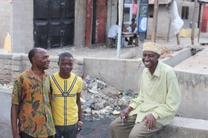
Posted: August 30th, 2011 | Author: Erica Hagen | Filed under: tandale, Tanzania | Tags: Community, Dar es Salaam, ICT4D, mapping, openstreetmap, Tandale, Tanzania, Ushahidi | Leave a comment »The Sokoni Sub-Ward Officer (right) and Community Members
Within the project we have effectively split into two groups along the lines of students and community members. The students are effectively bug hunting, filling in missed tracks and POIs. The community members are focusing on the submission of data into the Ushahidi instance, http://tandale.ramanitanzania.org/ushahidi.
Today was quite special in that the Sokoni sub-ward officer joined one of our community teams, reporting the problems within the community. They engaged fully in the process, finally seeing the problems they had found on the map.
I could feel the sense of achievement from the community members and students. The community members were animated at showing their work to the representatives of the local government, especially those who were on friendly terms with the officials.
Initially I feared that the dynamic of student and community would be one that would be difficult. The students are from Ardhi University and are the best and brightest urban planners that East Africa has the offer (the students come from Zambia, Kenya, Rwanda and Congo). They are on average technology literate and have, with some guidance, become power-users of JOSM and other OSM tools. Understandably the community took time getting to grips with the software and methodology.
We ran a Saturday session, now they are quite proficient with computers, GPS’ and cameras. Closing the gulf the community can help the students and vice-versa. Because we wish for the project to be sustainable the drive must come from the community members, and it has. They’ve really taken ownership of the project. Before they would be querying the OSM Tags, or how to pull tracks and waypoints off a GPS. Now they navigate all tasks with ease.
We start each mapping session at 0900 sharp. To be ready for this time, we arrive at 0830 to set the projector, plug laptops etc. Now I set the projector up, once I’ve handed out the laptops. Nearly all members (community and student) are present, ready and waiting. They, and by extension, Tandale, now own the project.
Originally posted by Mark Illiffe on his blog on August 27, 2011. Mark is working with GroundTruth in Tandale, Dar es Salaam this month introducing community mapping and reporting to Dar es Salaam residents, in a project supported by the World Bank and Twaweza.

